POLDER 2 - LAND SURFACES

LAND SURFACES RESULTS
Level 3 Land Surface POLDER2 bio-geophysical products
The Level 3 Land Surface products are the spectral directional albedos, the NDVI, the Leaf Area Index (LAI), and the Fraction of Vegetation Cover (FVC). The albedo are retrieved from the inversion of the linear reflectance model, and the NDVI is computed from the visible and NIR albedos. The LAI and the FVC are assessed through a radiative transfer model inverted using a neural network. More details are available on the Level 3 Land Surface algorithms page.
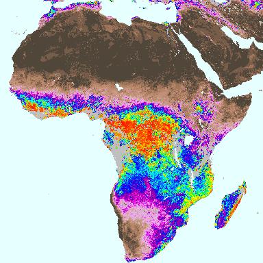 Figure 1: LAI over Africa, April, 15th 2003. | 6 0 |
On figure 1, the LAI over Africa displays large spatial variations representing the vegetation gradient. On the north hemisphere, the LAI, equal to 0 over the Sahara desert, increases gradually over the Sahel, the sparsely vegetated areas, and the wooded savannas, to reach its highest values over the equatorial evergreen forest. On the southern hemisphere, the LAI decreases from the closed rain forest, through the intermediate woodlands and shrublands to the Namibian desert. On figure 2, the Fraction of Vegetation cover shows the spatial coverage of the continental biomes.
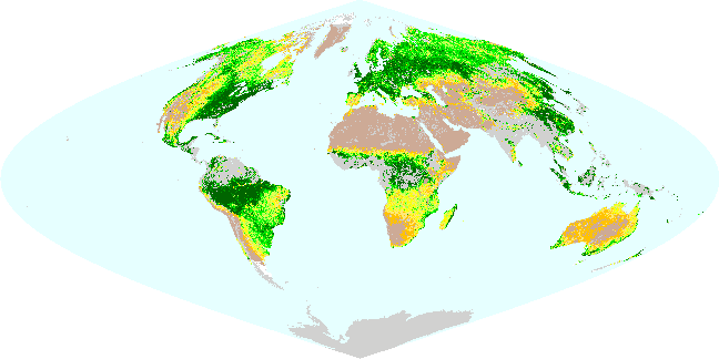 Figure 2: Global FVC map, July, 15th 2003. | 1 0 |
© CNES Copyrights 2004
